1/4 – Trey’s “Thunderstorms Tomorrow” Thursday Night Forecast
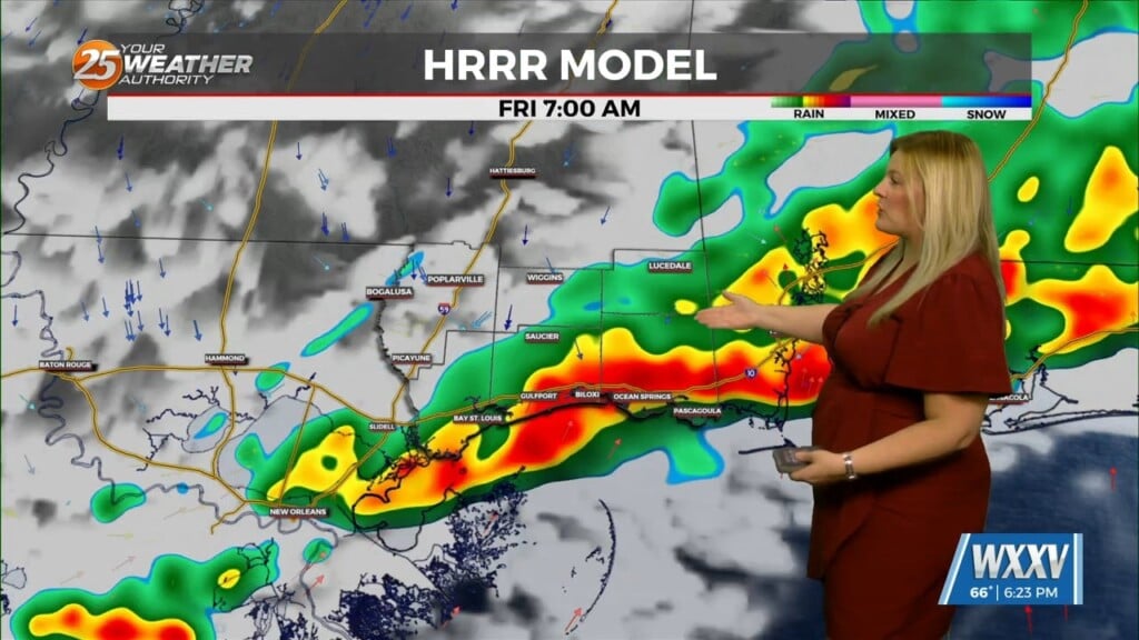
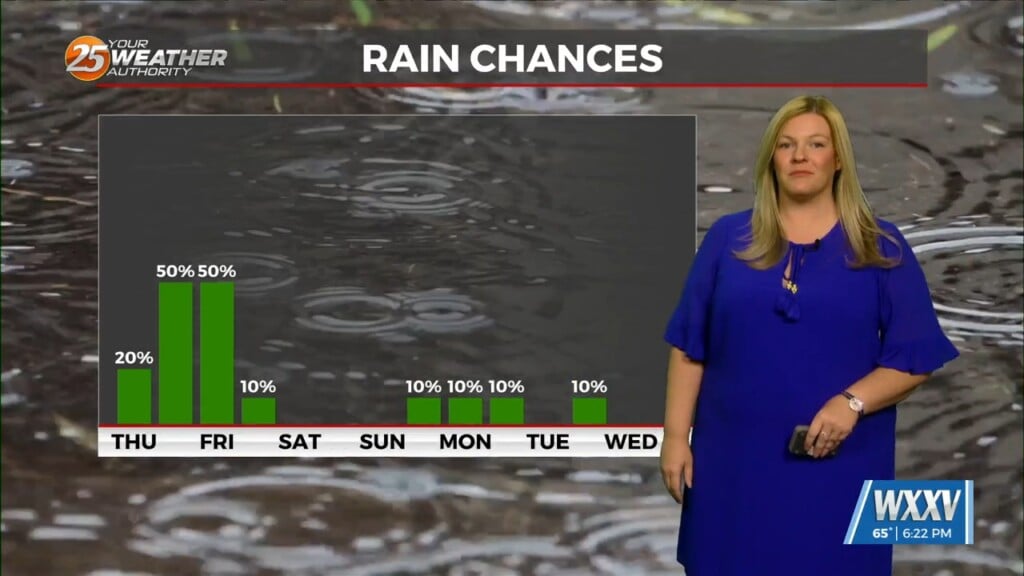
Thursday night, weak high pressure is moving east, as an upper level trough will push in and bring in strong low pressure into the area Friday night. Showers/Rain are both likely; and some elevated thunderstorms are certainly possible. While the severe risk seems low, all severe development can’t be completely ruled out, especially near the coast. The highest instability and shear will remain offshore, but some models are continuing to show some of that moving onto land. Also, if the front passes a little further north, that will open a window of storm potential in the afternoon hours. Rainfall wise, the line of showers and storms will be relatively quick moving. The best and heaviest rainfall will be Friday afternoon and overnight. It will then begin tapering off overnight.
As always: A cloudy day is no match for a sunny disposition. Be nice to each other.
-Meteorologist Trey Tonnessen-


