1/27 – Gradual afternoon warm-up with isolated rain chances later this week
Meteorologist Sam Lucey has a look at your forecast
Tonight will be mostly cloudy with patchy frost early, becoming widespread after 11 PM as temperatures drop to around 30 with calm winds.
Frost lingers on Wednesday morning through about 8 AM, then skies turn a bit more sunny with highs topping out near 54. We’re looking at another frosty night into Thursday morning though with lows near 31 and light north winds. Marine conditions stay calm through the rest of the work week, with northwest winds 5 to 10 knots and seas dropping to 1 foot or less.
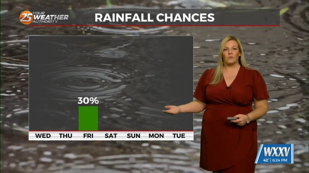
Friday night into Saturday is going to be a slightly rougher stretch of weather, with temperatures turning much colder and gusty north winds returning. Lows drop back down into the low 20s and upper teens overnight, with wind chill values looking like single digits.
Hazardous marine conditions will begin to develop as north winds increase to 25 to 30 knots and seas build to 5 to 7 feet overnight. We’ll likely see a Small Craft Advisory issued during this time, and possibly a Gale Watch too. Saturday stays sunny but brisk with highs near 37, with little improvement into Sunday.