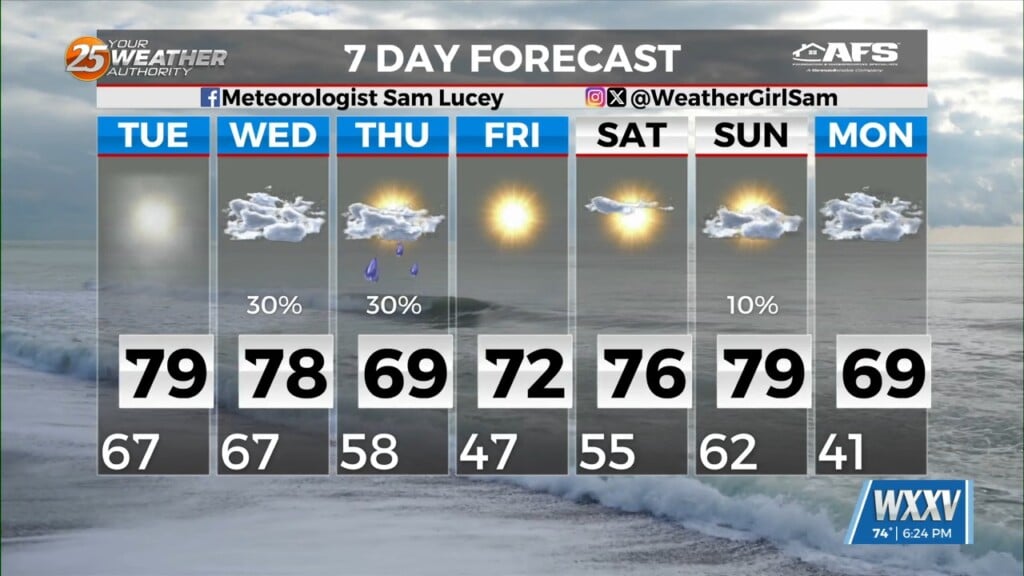
06/14 – Brantly’s “Hot Day Tomorrow” Sunday Night Forecast
Locally, primarily easterly low level flow with drier air attempting to work in from the northeast. Isolated thunderstorms have developed, primarily on lake/sea breeze boundaries. Outside of the spotty storms, temperatures generally around 90 degrees with dew points upper 60s to lower 70s.
Considering the northerly upper flow and associated dry air, will need to keep an eye out for high temperatures across northeast portions of the area. Not out of the question that highs could spike into the lower/mid 90s briefly around midday-early afternoon before the sea breeze kicks in.
With limited moisture across the area, shower or thunderstorm development for the next 3 days should be too low in coverage to mention, if any occurs at all. On the water, we don’t anticipate much in the way of marine issues through the forecast period. We expect mainly onshore flow during the daylight hours and offshore at night.

Leave a Reply