04/25 – Brantly’s “Clear” Sunday Night Forecast
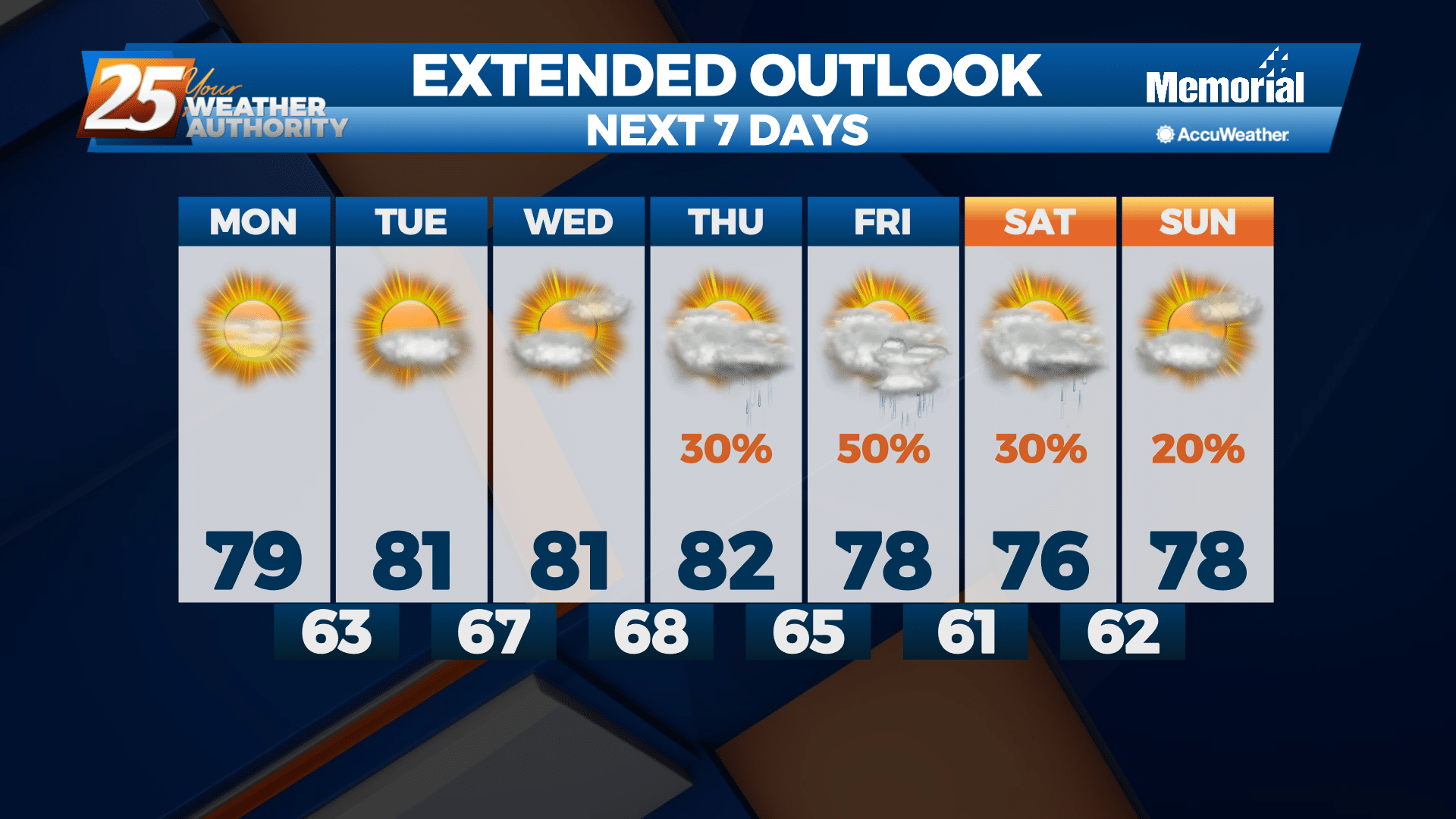
Clear skies tonight and only a few scattered clouds are expected on Monday. Light northerly winds will become light and variable overnight, then gradually become more southeasterly on Monday as the return flow begins to develop. A cool night is on tap tonight with lows ranging from the upper 40s to lower 50s over inland areas to the mid and upper 50s along the coast.
A little warmer on Monday as the return flow sets up, with highs mainly ranging from the 80s over inland areas to the mid to upper 70s right along the coast where the onshore flow off the cooler Gulf waters moderates temperatures somewhat. Lows Monday night dip into the middle to upper 50s.
High pressure continues to dominate the southeastern U.S. through Wednesday night, giving us calm conditions with little to no chance for rain. Our high pressure system shifts east into Wednesday and Wednesday night as a low pressure system slowly shifts east across the central Plains states. Temperatures will be on the warming trend, with highs Tuesday and Wednesday reaching lower to middle 80s with some upper 80s possible over interior areas near Hattiesburg. Lows will be in the lower to middle 60s for Tuesday and Wednesday nights.


Leave a Reply