11/29 - Jeff's "Frigid Start" Wednesday Morning Forecast
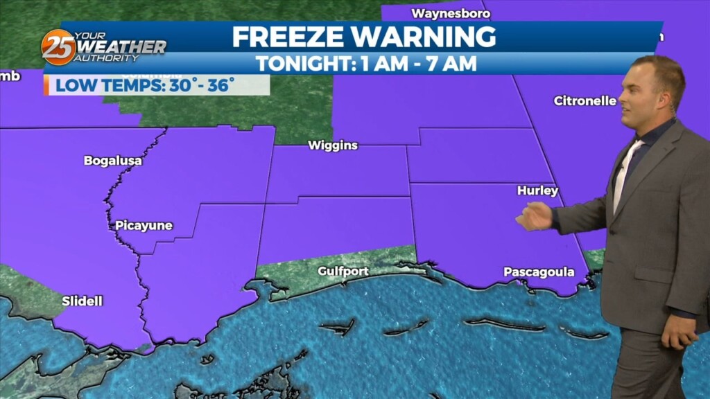
A Freeze Warning remains in effect until 8 AM for our entire area. A frigid start under clear skies will yield to a quick warm-up with lots of…
A Freeze Warning remains in effect until 8 AM for our entire area. A frigid start under clear skies will yield to a quick warm-up with lots of…
Temperatures will likely drop like a rock this evening and then a steady slow drop through the night, especially in the drainage areas along the Pearl and Pascagoula…
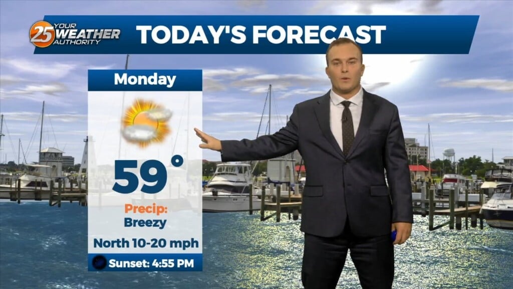
Another cool and breezy afternoon will be in store for us. Temperatures will be similar to yesterday but winds will be slightly more tolerable. Lots of sunshine…
It is another cold start to the day with winds still remaining in play. Temperatures in the upper-30s to lower-40s will have a wind chill factor to…
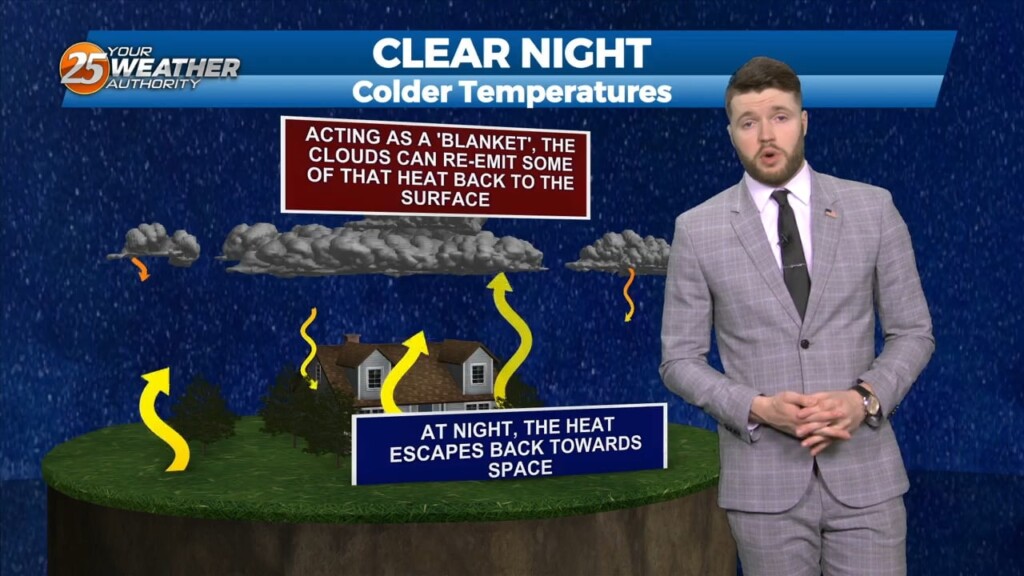
High pressure continues to build into the area tonight and winds will relax. With low dewpoints and light to calm winds, the big question with overnight lows will…
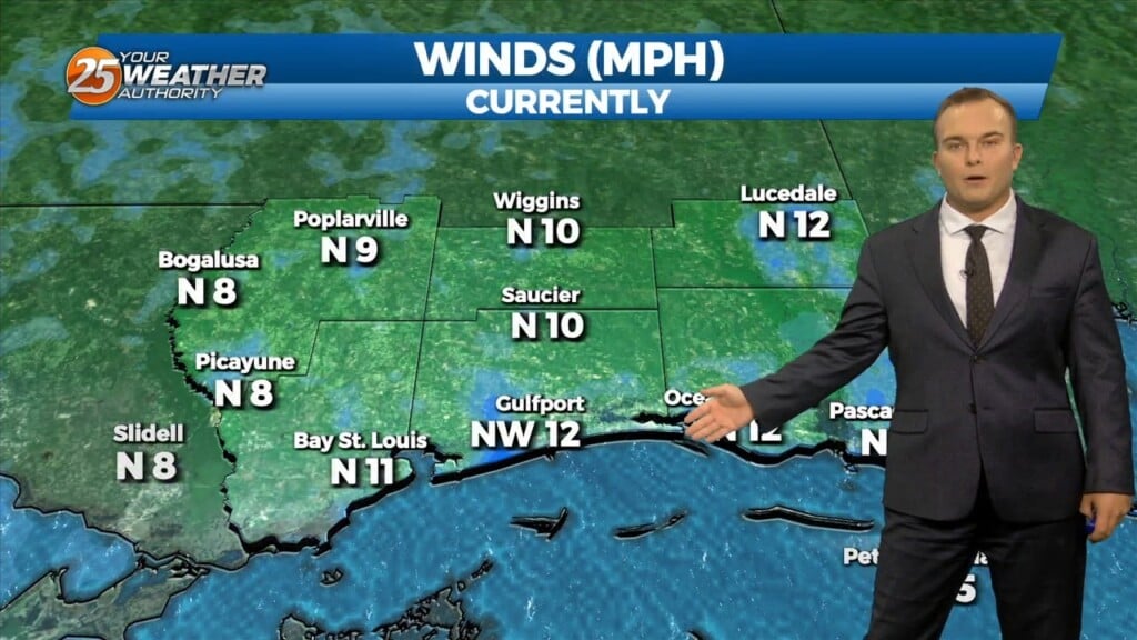
Some thin, upper-level clouds move in this afternoon. Outside of that, sunshine does dominate and expect cool conditions. It will be breezy if not windy at times.…
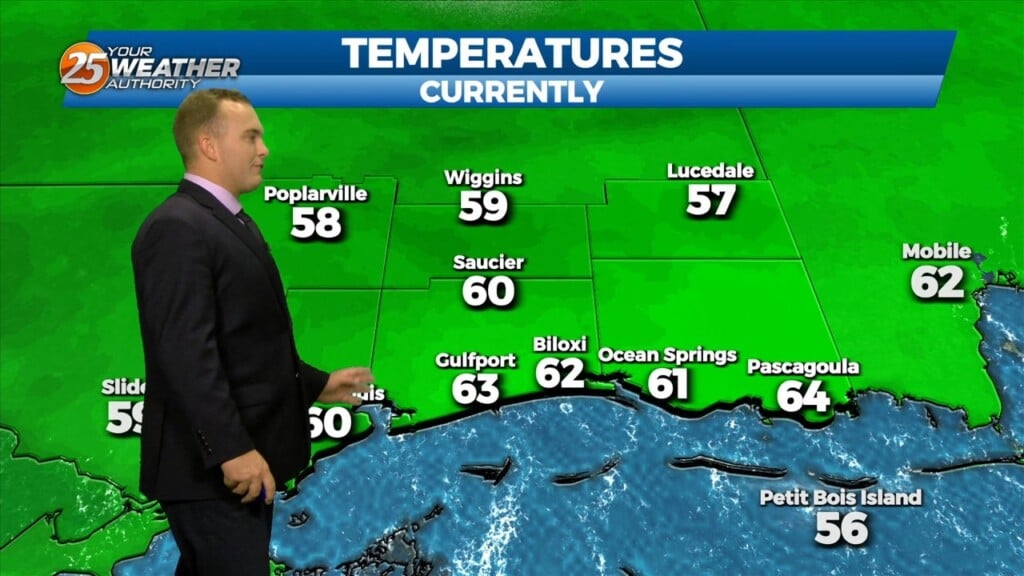
It is a much colder start this morning with temperatures in the 40s and breezy northerly winds behind a cold front. Expect sunshine to dominate early but…
Some opportunities for sunshine return this afternoon and rain chances are out of the equation. Expect cool conditions and a light breeze out of the northeast. Clouds clear…
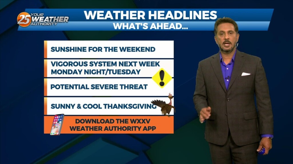
Cloud cover remains dominant for a lot of Black Friday with a cool and somewhat unsettled pattern around. There will be a 20% chance of…
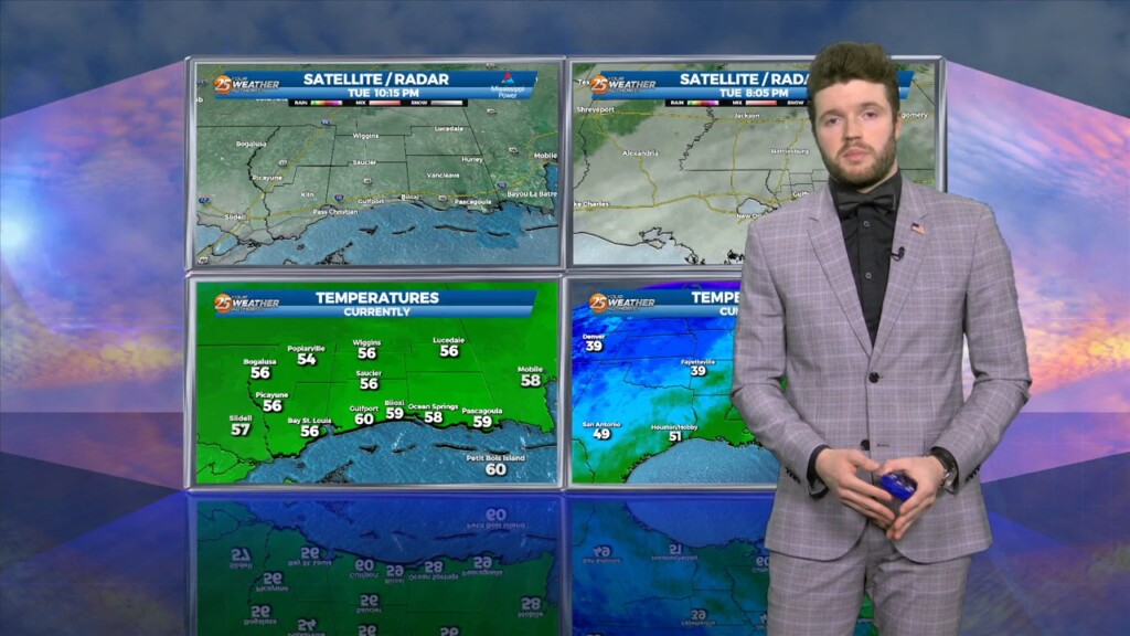
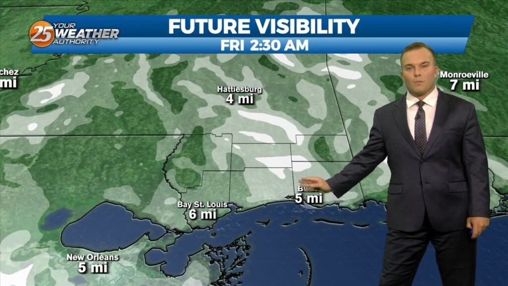
n Wednesday Night: Dewpoints are one of reasons the Mississippi Gulf Coast will be chilly tonight. Overnight lows will be a good bit cooler than Tuesday night. Dewpoints dropped…

High temps will struggle each day through Friday to reach the 60s as colder/drier air continues to move in from the north. The area…
The cold front moved out over the gulf yesterday and cool air has been slowly filtering in behind it. This will continue today keeping high…
The cold front has finally made it though the area with breezy northwest winds in its wake. At the surface, a large area of high pressure is…
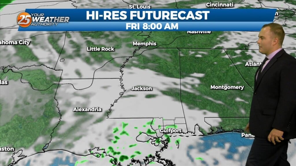
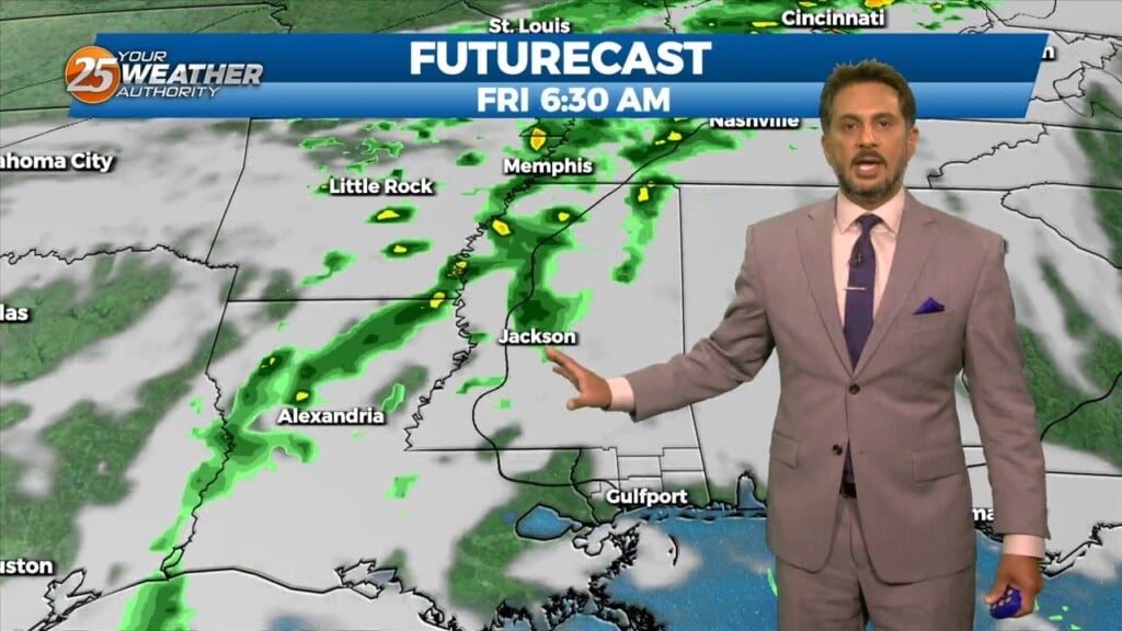
Widespread rain chances have pushed to the east this morning as we await the arrival of the associated cold front. Some rainfall will continue shortly after daybreak. Winds…
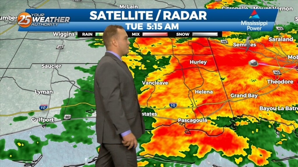
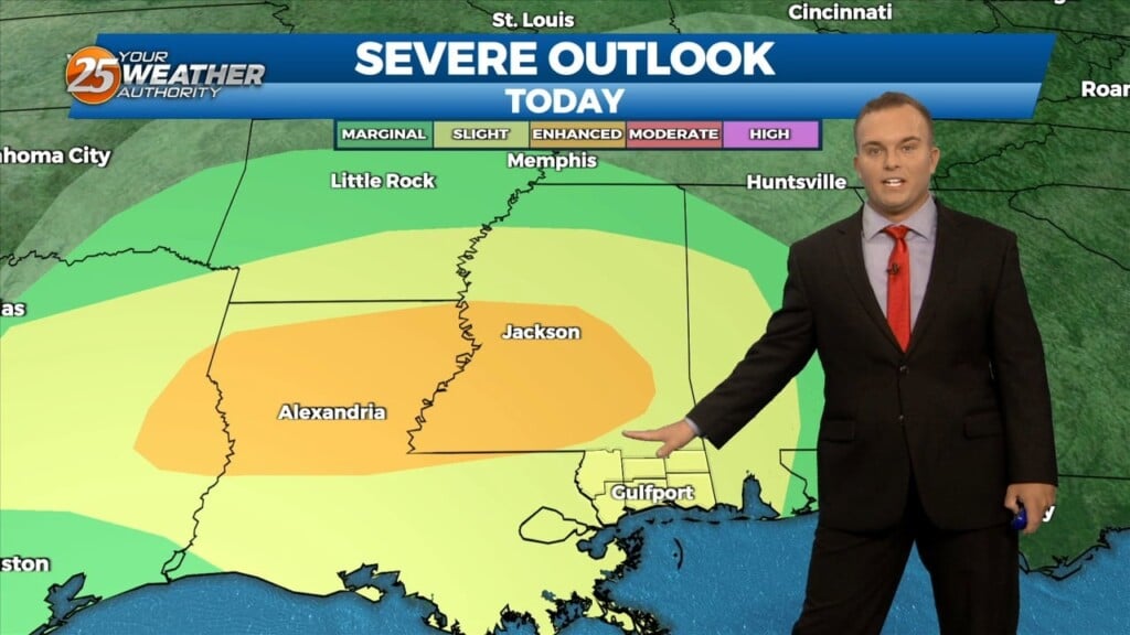
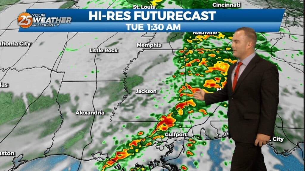
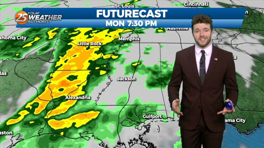
Monday's overnight main area of severe concern appears to be southwest Mississippi and adjacent Louisiana parishes which fits the Enhanced area. Southwest flow aloft will slowly but steadily…
Cloud cover will be dominant this afternoon with humidity continuing to increase. There will also be a 30-40% chance of isolated showers with an embedded rumble…
Today starts off with cool-to-mild conditions that will change through the day. Southerly winds will help increase moisture, especially this afternoon. This all happens ahead of…
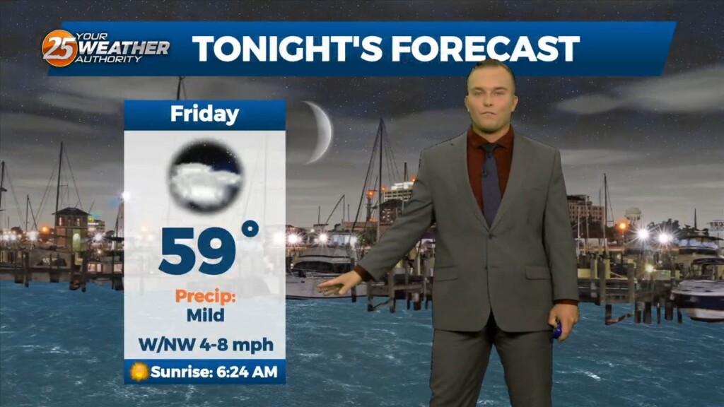
A weak cold front and upper level trough will begin to move toward our region late tonight and early Saturday. Ahead of the front we may see…
Clouds dominate again this afternoon with a mild day overall. A cold front to our northwest will move in overnight which will provide for more…
The midweek upper disturbance is now over Florida with weak high pressure over Texas. A northern stream disturbance extends from Hudson Bay to Lake Superior to the…

A trough digging over the Great Lakes will start approaching the Gulf Coast, and bring a cold front along with it. Ahead of the front, compressional warming…
Winds relax this evening as an area of low pressure in our region fades into memory. Clouds will build back in overnight and there could be…
Some sunshine returns this afternoon, particularly along the beachfront. Temperatures will be slightly warmer and right at the average high temperature this afternoon. Winds will also back…
The upper level support for the system to the SW has now moved to the NE. The surface feature is to the south of the…