5/23 - Trey Tonnessen's "Always Watching" Thursday Night Forecast
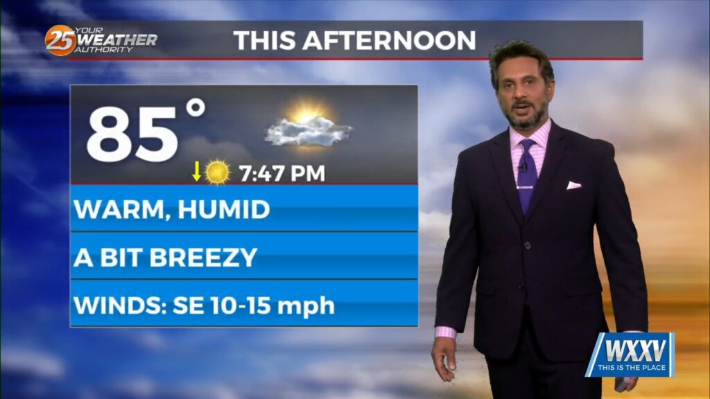
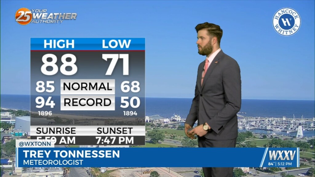
The hot temperatures continue through Monday with temperatures in the lower 90s. Most locations will be just a little below record daytime highs and high-lows. Our…
The hot temperatures continue through Monday with temperatures in the lower 90s. Most locations will be just a little below record daytime highs and high-lows. Our…
An upper level ridge centered just west of the Bay of Campeche will continue to be expanded northeast across the Gulf States. This will maintain hot…
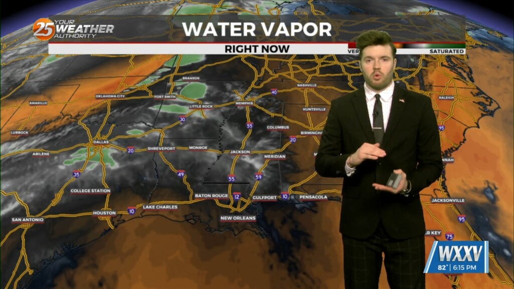
A disturbance moving east over central Mississippi this morning will help cause some shower activity over the northern half of the area. There will be some boundaries…
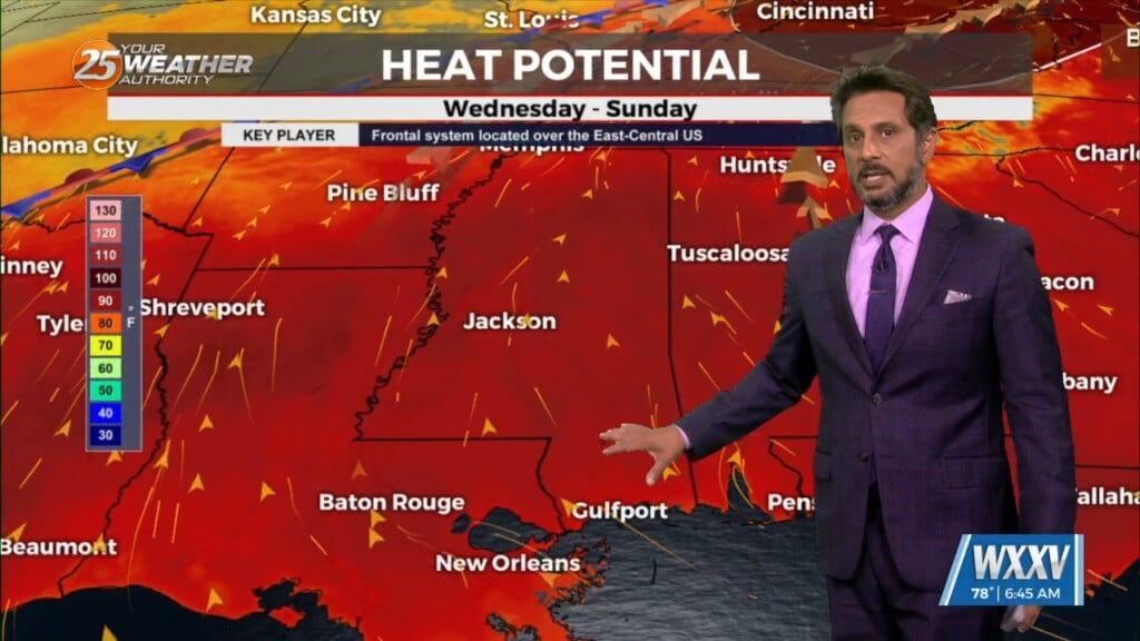
Our area will still be under the influence of a slow building ridge through the weekend and Memorial Day, with high temperatures reaching into the low…

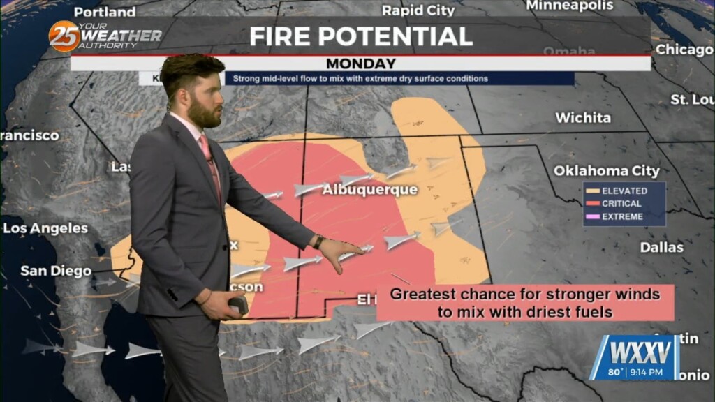
Ridging continues to dominate the area for the most part with dry conditions expected. The only exception to this tonight will be out of the WXXV…
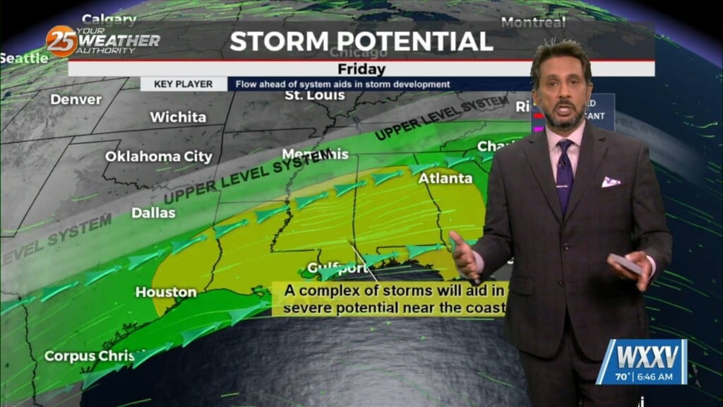
The fight between a series of fast moving disturbances sliding along the I-20 and further north and high pressure to the E/SE will be the main forecast…
The forecast for the rest of this workweek doesn't look to change much. High pressure will maintain hot and rain-free conditions. Temperatures will creep up a…
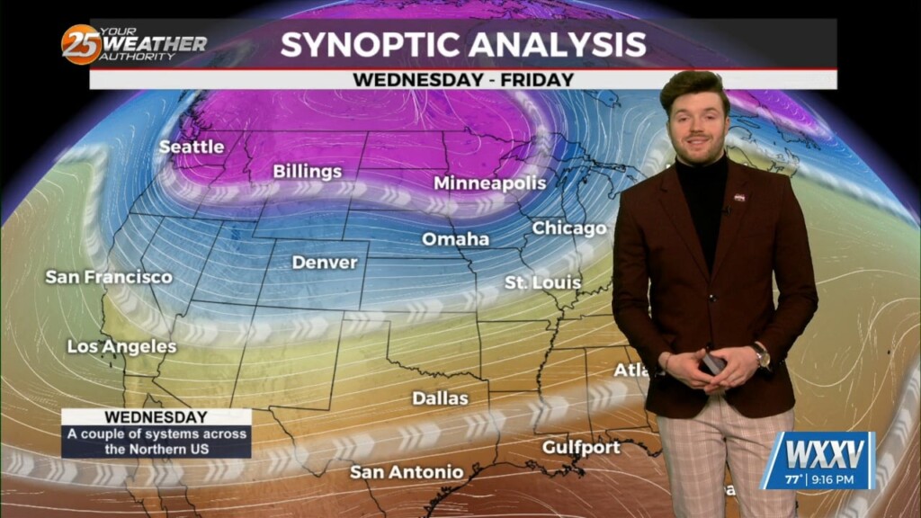
An upper level high is currently centered over central Mexico just southwest of Texas. The axis of this high currently extends northeastward across the southeastern United…
High pressure through the region will continue to provide subsidence and warming through the period. This will result in a dry forecast through the…
Little change in the ongoing pattern of deep layer high pressure currently in place across the Gulf South is expected through Thursday night. The result will be…
Like the near-term, there is not really not much to talk about in the extended portion of the forecast. High pressure will maintain hot and rain-free…
An upper level ridge is currently centered over central Mexico just southwest of Brownsville Texas. The axis of this high currently extends northeastward to the southern periphery…
High-pressure and strong dry air in the mid/upper levels of the atmosphere will continue. This will effectively suppress cloud development to below the inversion, and result in…
Strong high pressure will dominate the Gulf South through the entire short term period. The deep layer subsidence associated with this high pressure will result in…
A quiet pattern has evolved for our local area. Aloft, a dry northwesterly flow around the eastern periphery of a high over Mexico, will remain across…
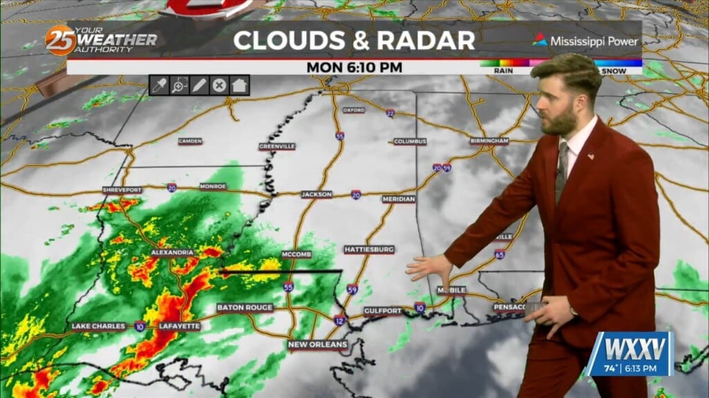
The old frontal boundary is stalled near the coast this morning and drapes inland near Terrebonne Parish westward to Beuregard Parish. The back end of this front…
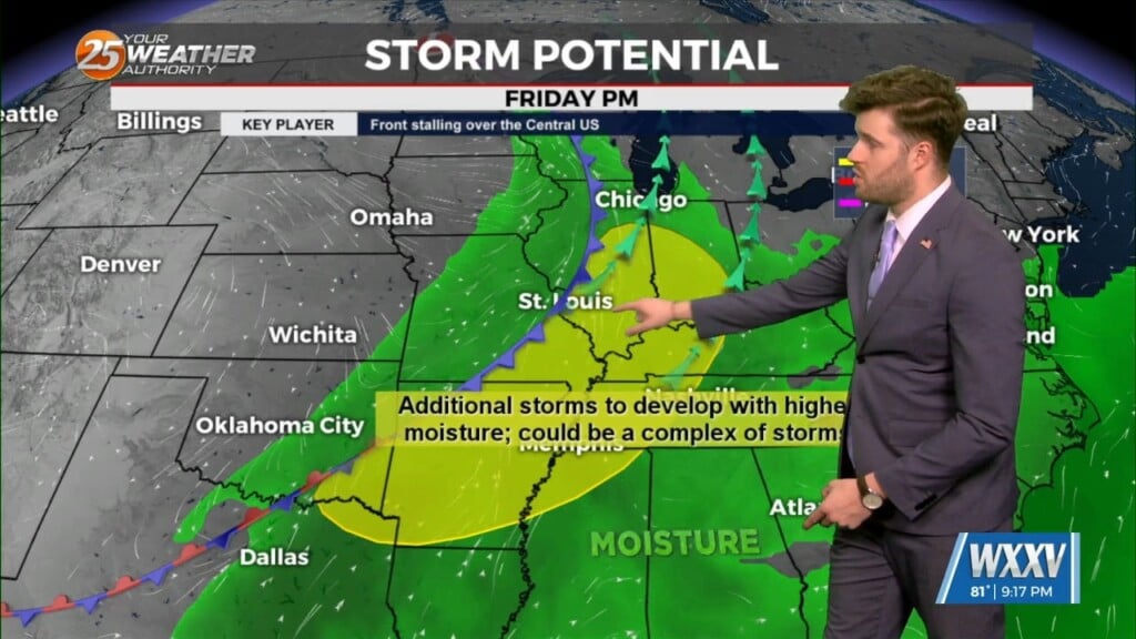
A cold front is currently slowly moving south through the area this morning. This boundary will be very important for this forecast, as it will…
An area of weak low-pressure overhead will slide to the east and dissipate. We will transition into somewhat lower dew-points and maintain those conditions for the next…
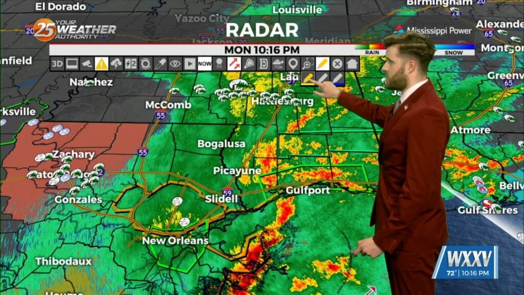
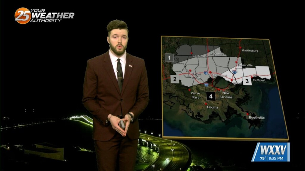
Overview: Severe Thunderstorm watch still in place for coastal MS and coastal southeast LA. Possible Wake Low trying to develop behind the storms Hazards: All…
The developing squall line over southwest Louisiana has already had a history of producing a few tornadoes and widespread wind damage. This line is expected…
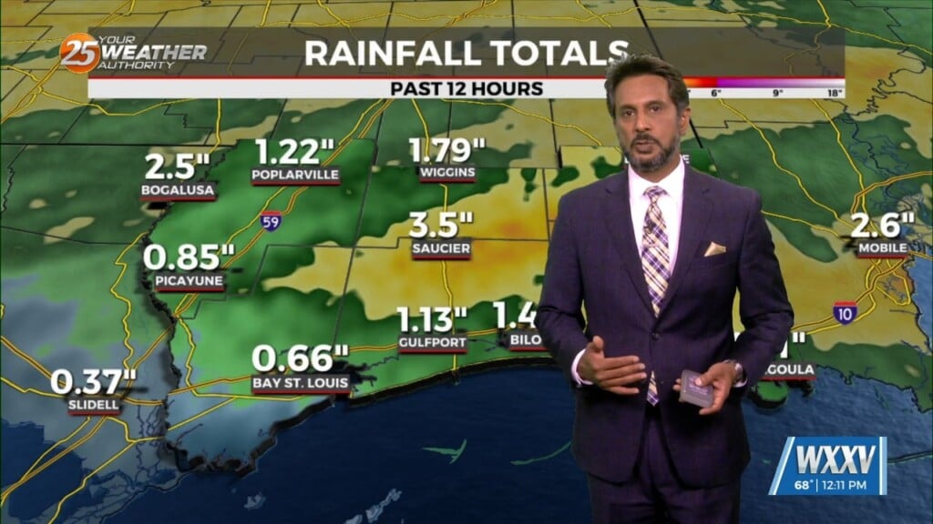
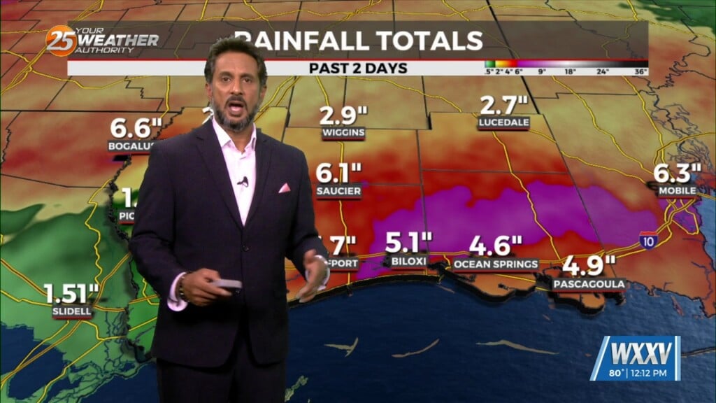
THREAT FOR HEAVY RAINFALL AND SEVERITY. The Flood Watch will remain as rainfall amounts are still coming in from 3 to 6 inches with the…
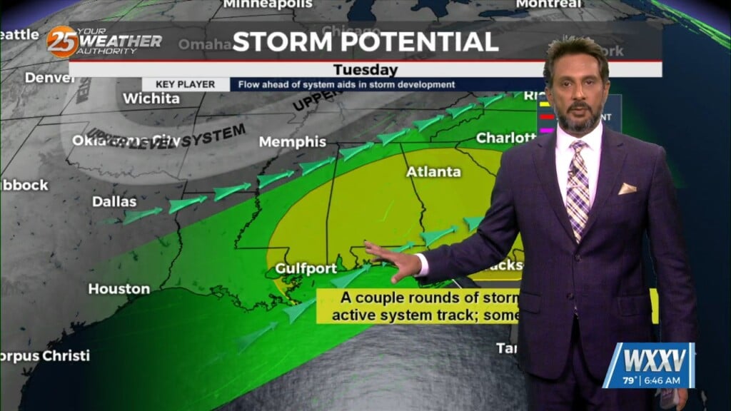
The upper flow is now supportive and subsequent lower level flows are also lining up to support the training of HEAVY RAINFALL. The first of 2 rounds…
Good Sunday evening! Severe weather is back in the forecast, even though our risk areas are not as high as several places in the region have…
Cold front is moving through the area this morning and will be slow to do so. Dry air will move over the area bringing cloud…