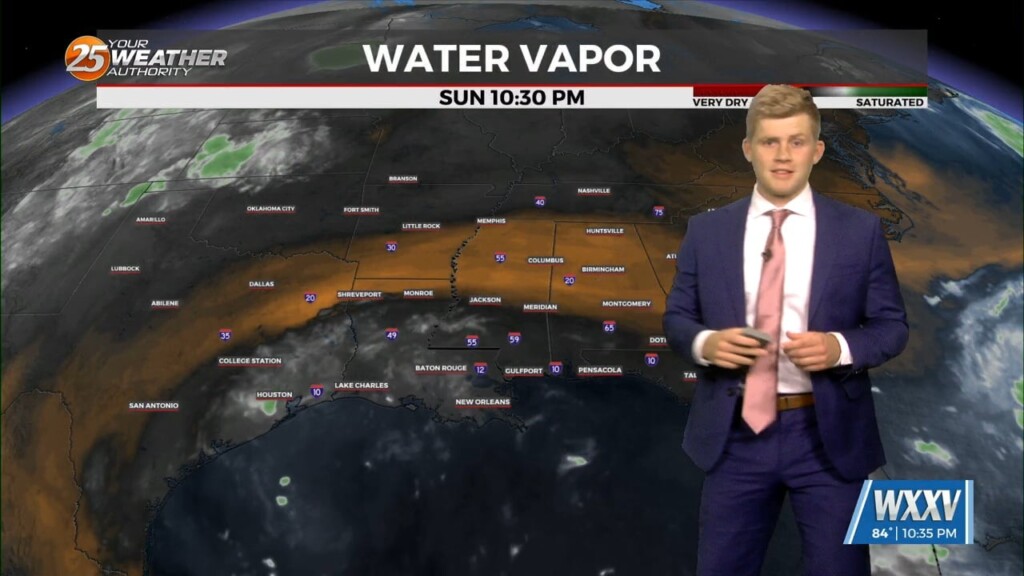
8/25 - Sam Parker's "Moisture Moving" Sunday Night Forecast
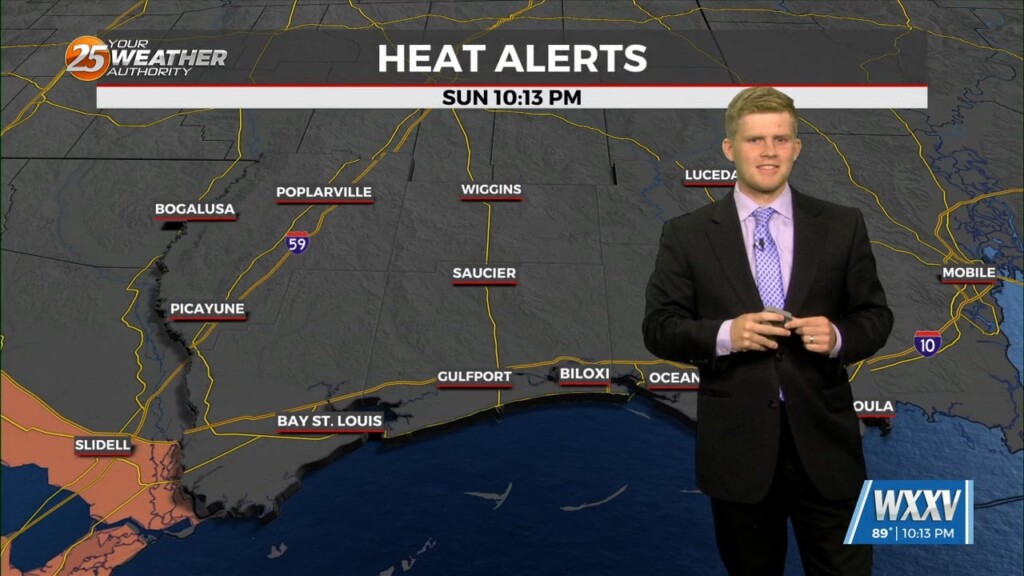
Moisture from this weekend still cycling through our area. bringing our heat index values up but not heat advisory criteria. With this moisture it looks to bring…
Moisture from this weekend still cycling through our area. bringing our heat index values up but not heat advisory criteria. With this moisture it looks to bring…
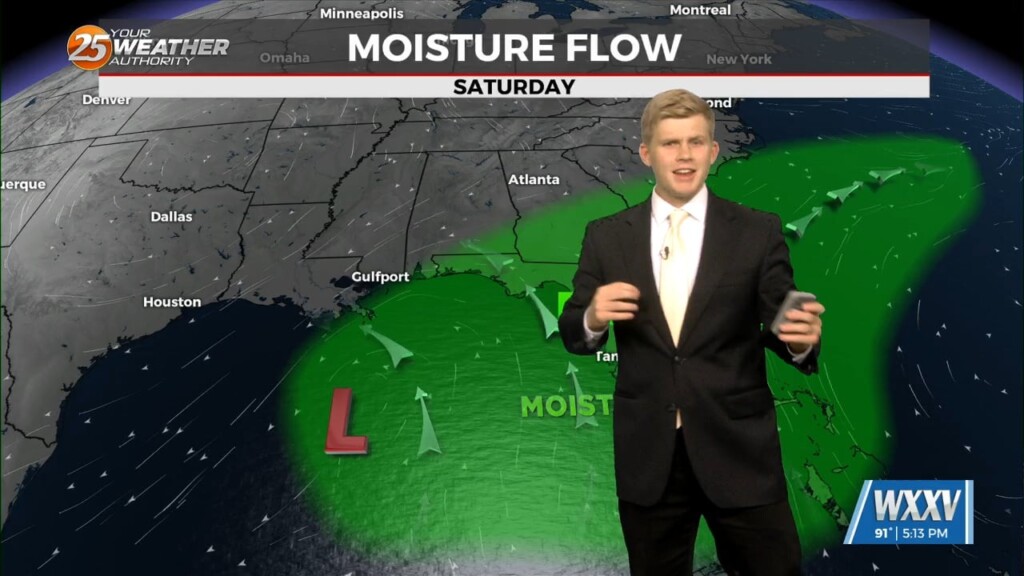
An upper low, and moisture plume will move westward through the northern Gulf over the weekend. This will result in a gradual increase in rain chances across…
Things are changing noticeably on us now after a similar couple of days. We've now put our lowest temperatures and lowest humidity behind us, and while today will still…
We will see some surface moisture moving back into the area after sunset this evening. This isn`t intolerable but will be i little more moist than the…
The last couple of days have been cooling slightly and drying out, and while those pleasant conditions will continue another few days they're starting to see changes. This morning…
Expect Friday to be mostly similar to the previous two days as dry air looks to hang onto the area for one more day. However, medium-range…

Today as the dry air behind the frontal passage hangs around. Very dry mid-level conditions brought by the northerly flow around the ridge has kept today…
Dry air aloft and lower humidity at the surface continue to dominate South MS weather, leading to an even cooler morning and a pleasant afternoon ahead! It won't be…

Something we have been talking about over the past few days is a large ridge building over half of the country. That ridge was centered over…
That's right, we may be heading deeper into summer, but for the next few days it's finally cooler and even a little drier! Let's go ahead and temper those…
On Tuesday, a front will continue to reside just west of our area. An abundance of dry air again should keep our region dry…
Today is already slightly drier, but the humidity will fall even more in the days ahead as a weak front pushes drier air into South MS. For today, it…
The showers and thunderstorms look to dodge our area and the frontal boundary will help our temperatures go down to what they should be this time of…
Saturday will be similar to today as the higher moisture content hangs around the area for one more day. PW will remain above the…
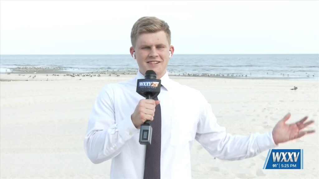
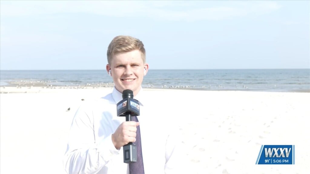
Meteorologist Sam Parker is braving the heat and humidity to bring you the live weather where you live!

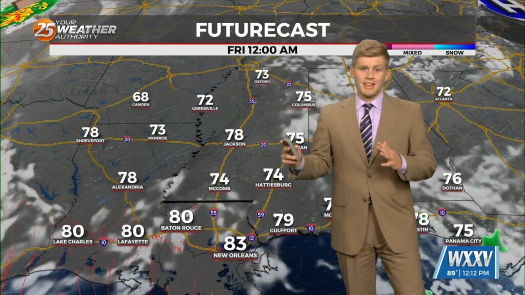
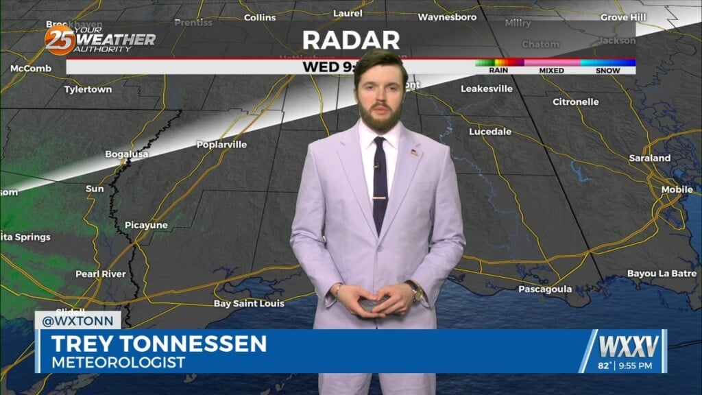
Showers and thunderstorms across the state line into Louisiana continue Thursday night as we begin our 9:00 PM newscast. Cold pool driven convection continues to dive…
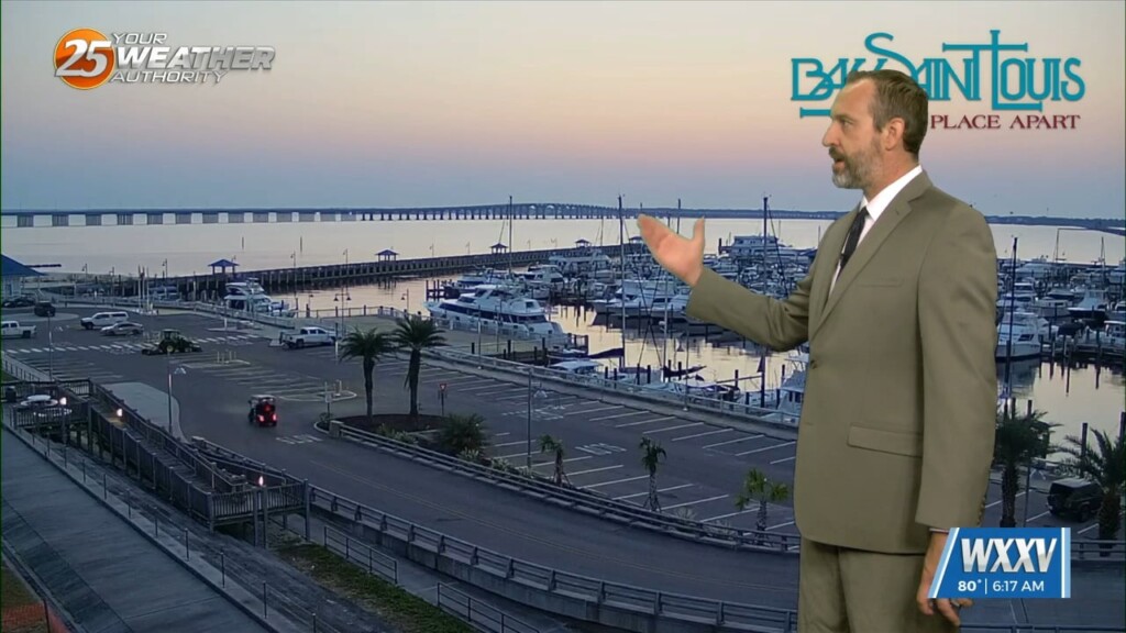
The WXXV Weather Authority Team is actively covering weather from where you live. That is why we are going to send it on over…
The WXXV Weather Authority Team is actively covering weather from where you live. That is why we are going to send it…
Today and Friday will look to be fairly similar like the past few days. A few more storms around each day taking full advantage of the strong…
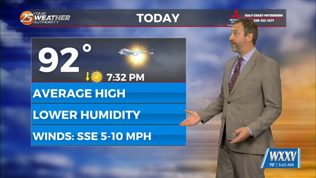
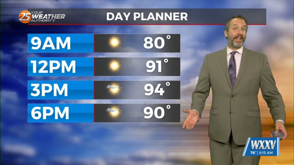
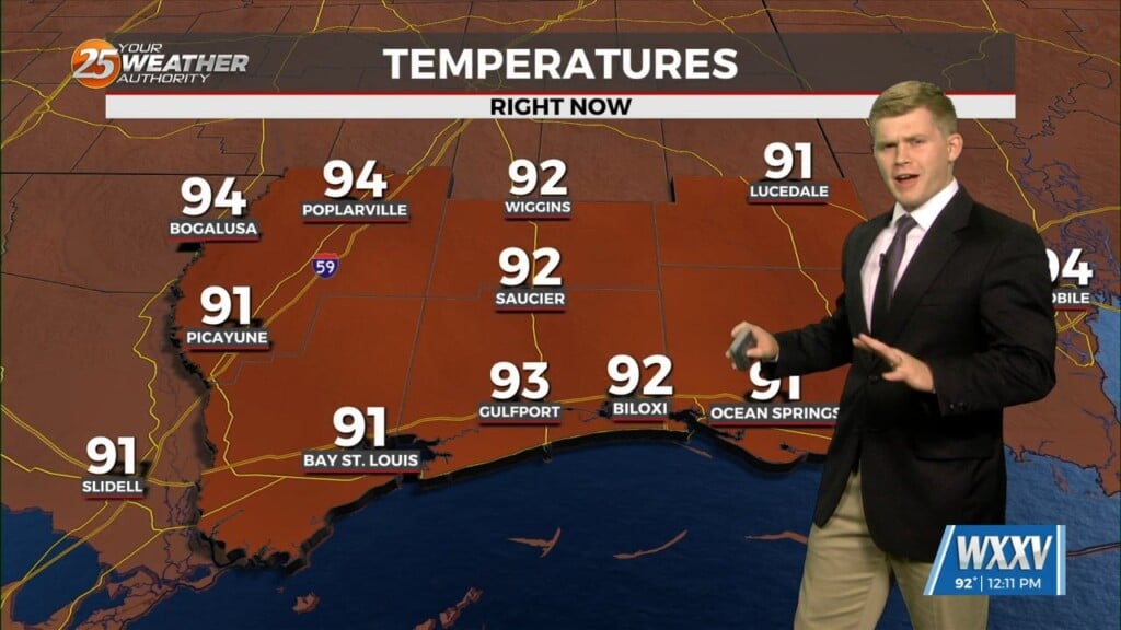
Today has been forecast to be the hottest day of the week for the last several days, as the temperature and humidity inch up to their highest levels. That's…
Ridging is expected to shift a bit eastward tomorrow. That would lead one to believe that coverage of storms should be less than today, with…
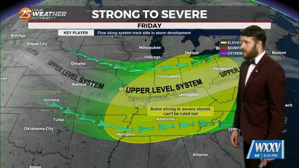
An upper ridge axis links from New Mexico to northern Louisiana this afternoon; with northern stream shortwaves over New York and Illinois. At the surface, a…
The title above is correct, while you likely couldn't tell without looking at the numbers, we are in for a slightly "cooler" week ahead! That's not to…
High pressure will continue to dominate the weather pattern for the next few days. Tonight through Tuesday morning, conditions will continue to be drier and hot.…